
New Interactive Map Shows EV Charging Stations Near U.S. National Parks

Snacks: Check. Road trip tunes: Check. An interactive map showing electric vehicle charging stations at the national park you are visiting: Check, check, and check.
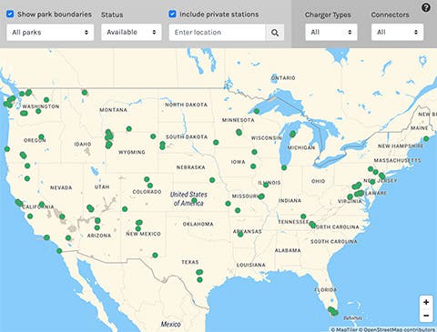
As electric vehicle (EV) adoption grows — and tourism to U.S. national parks skyrockets — many visitors to the nation’s wild spaces have the same question: Can I charge my car there? Now, those visitors can use a new interactive tool built by the National Renewable Energy Laboratory (NREL) to check if an EV charging site can be found at any of the United States’ more than 400 national parks, monuments, and historic sites.
Developed in collaboration with the National Park Service (NPS), the tool is now live on the NPS.gov website — inviting visitors to help keep the nation’s most beautiful heritage sites pristine and emissions-free.
NREL researchers built the NPS Station Locator Tool from the bones of the Alternative Fueling Station Locator, an interactive map that shows nearly every nonresidential alternative fuel station in the United States and Canada, from EV chargers to hydrogen, biodiesel, ethanol, natural gas, propane, and renewable diesel fuel locations. The research team, led by Matt Rahill, an NREL software developer, used the Station Locator’s vast data repositories to create a more curated experience for national park visitors.
“Developing an EV charging map for the National Park Service was a way to harness work that we already do at NREL to track charging infrastructure nationwide,” Rahill said. “If we were starting from scratch, this project would have taken much longer. Instead, we were able to leverage the existing data from the Station Locator tool and tailor it for national park visitors.”
Decades of Data Power Daily EV Charging Station Updates
The data powering both the Station Locator tool and the NPS EV charging map stretches back decades.
Abby Brown, an NREL transportation project manager who serves as the Station Locator’s data collection lead, explained that NREL began manually collecting the nation’s EV charging data in 1991, when the U.S. Department of Energy launched the Alternative Fuels Data Center. In 2014, NREL started to automate this data collection for EV charging networks that share their data through an application programming interface (API). Now, the laboratory collects daily updates on networked charging stations directly from the EV charging service providers who maintain them and imports the data directly into the Station Locator — in addition to manually collecting data on non-networked chargers.
For these reasons, the Station Locator is the continent’s largest and most reliable source to find an alternative fuel station. And that data feeds directly into the NPS EV charging map.
“To build the National Park Service map, we ingested 11 charging networks’ APIs, which feed data into the tool automatically, rather than collecting the data manually,” Rahill explained. “Then we filtered the data to show only the EV charging stations that are en route to or directly associated with one of the 400-plus national parks, monuments, and historic sites.”
“This tool is meant to streamline the visitor experience for those who want to drive an EV to a national park,” Brown added. For a fuller portrait of the nation’s EV charging landscape and alternative fuel sites, she noted, visitors should check the main Alternative Fueling Station Locator map.
To further simplify the charging experience for EV drivers, Rahill’s team built a number of useful filters into the map. For instance, users can customize the map to show a specific type of charger, the level at which it charges — from 120 to 240 volts, plus DC fast-charging levels of 400 volts or more — and to show only the EV chargers located near a specific park or monument. The map will even show the hours the charger is open to the public. And because Station Locator data is used to power the NPS tool, it updates daily, giving users the most current data possible on new and existing charging sites.
Building a Greener Future for National Parks, Monuments, and Historic Sites
The new EV charging map is in strong alignment with NPS values, including a gradual transition to clean energy.
The National Park Service’s Green Parks Plan, the third edition of which launched in 2023, outlines new steps to achieve net-zero greenhouse gas emissions and zero-emission transportation methods. A key step in the plan to “green” its transportation is to install the infrastructure to support visitors’ electric and alternative fuel vehicles — and inform them of existing infrastructure through new tools like the EV charging station map. Because private cars remain one of the most convenient ways to travel to remote sites like national parks, helping drivers to reduce their carbon emissions will support a number of environmental goals, from reducing pollution to decreasing noise levels near wildlife habitats.
“We are proud to have worked with the National Renewable Energy Laboratory to help make EV charging more accessible for visitors to our parks, monuments, and historic sites,” said Jennifer Madello, division manager for NPS’ Park Facility Management Division. “The National Park Service serves as a model for environmental stewardship, but we can’t meet our sustainability goals alone: The public plays an integral role in this work. The new NPS EV charging map, developed with NREL’s support, invites visitors to participate in and contribute to our goals of supporting net-zero emission transportation, climate resilience, and environmental justice.”
And the new EV charging map is just one of a number of projects NREL and NPS have partnered to complete in pursuit of clean energy — one that could impact visitors to national parks, monuments, and historic sites across the country.
“The National Park Service and NREL have had a longstanding partnership over the years, from providing data analysis to support bus electrification at Zion National Park to providing technical assistance in reducing overall park emissions,” said Kaylyn Bopp, who served as the liaison between NREL and NPS for the project. “National parks face unique challenges, and NREL is uniquely positioned to help. It’s amazing how we can make a few tweaks to the work we already do and see it provide huge value to one of our federal partners — and people all across the nation.”
Learn more about NREL’s sustainable transportation and mobility research. And sign up for NREL’s quarterly transportation and mobility research newsletter, Sustainable Mobility Matters, to get the latest news.
By Anna Squires. Courtesy of NREL.
Featured image: Staff at an electric vehicle charging station at the Mammoth Hot Springs Hotel. Courtesy of NPS/Herbert.

Sign up for CleanTechnica's Weekly Substack for Zach and Scott's in-depth analyses and high level summaries, sign up for our daily newsletter, and follow us on Google News!
Whether you have solar power or not, please complete our latest solar power survey.
Have a tip for CleanTechnica? Want to advertise? Want to suggest a guest for our CleanTech Talk podcast? Contact us here.
Sign up for our daily newsletter for 15 new cleantech stories a day. Or sign up for our weekly one on top stories of the week if daily is too frequent.
CleanTechnica uses affiliate links. See our policy here.
CleanTechnica's Comment Policy