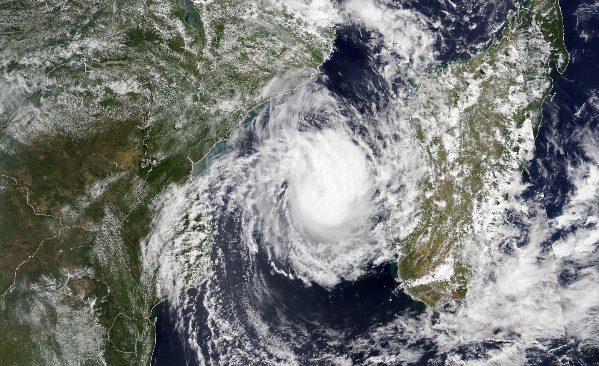
The Visible Infrared Imaging Radiometer Suite (VIIRS) on the NOAA-20 satellite acquired this image of the storm at 1:10 p.m. local time (11:10 Universal Time) on March 8, 2023. An infusion of dry air and the storm’s position over relatively cool waters meant Freddy was weakening and the eye had broken down when the image was acquired. However, forecasters at the Joint Typhoon Warning Center warned that Freddy will likely still hit Mozambique with sustained winds of 139 kilometers (86 miles) per hour, making it the equivalent of a category 1 hurricane.
Over the course of Freddy’s 32-day journey, the World Meteorological Organization says the storm likely became the longest-lasting tropical cyclone on record. The previous record holder, Hurricane John, persisted for 31 days in the Central Pacific in 1994.
Meteorologists tracking Freddy’s accumulated cyclone energy (ACE) — a metric that incorporates both intensity and duration — say the storm had an ACE of 72 as of March 7, 2023. That put it in second place for the most accumulated cyclone energy generated by a single storm since 1980, according to Colorado State University atmospheric scientist Philip Klotzbach. Ioke, a 2006 hurricane in the central Pacific, holds the record with an ACE of 85.
Article and featured image courtesy of NASA Earth Observatory. Image by Lauren Dauphin, using VIIRS data from NASA EOSDIS LANCE, GIBS/Worldview, and the Joint Polar Satellite System (JPSS). Story by Adam Voiland.
Sign up for CleanTechnica's Weekly Substack for Zach and Scott's in-depth analyses and high level summaries, sign up for our daily newsletter, and follow us on Google News!
Advertisement
Have a tip for CleanTechnica? Want to advertise? Want to suggest a guest for our CleanTech Talk podcast? Contact us here.
Sign up for our daily newsletter for 15 new cleantech stories a day. Or sign up for our weekly one on top stories of the week if daily is too frequent.
CleanTechnica uses affiliate links. See our policy here.CleanTechnica's Comment Policy